Groundcover
Groundcovers are vegetation areas filled with a plant species according to density parameters and represented as a hatch pattern for the 2D display.
Insert a groundcover
After running the laGroundcover command, the Groundcover insert dialog box will appear. This dialog shows the basic Groundcover options in different tabs:
- Groundcover: Parameters of the groundcover
- Format: Format of the plant species in the groundcover.
Steps:
- Select a groundcover species from the list. Click on the Browse... button to select a new one from the Plant Database.
- Select the rest of insert parameters (presentation mode, density, plant scale, and hatch pattern) and click OK to close the dialog.
- Pick an existing curve in the model to define the groundcover boundary, or draw it through any of these options in the command line:
- Polyline: the groundcover will be created as if you were drawing a polyline.
- Spline: the groundcover will be created as if you were drawing a spline.
- Circle: the groundcover will be created as if you were drawing a circle. The first click determines the center of the circle, and the second click determines the radius.
- Arc: the groundcover will be created as if you were drawing an arc. The first click determines the insert point. The second click determines a middle point in the arc. The third and last click determines where the arc ends.
- Rectangle: the groundcover will be created as if you were drawing a rectangle. The first click determines one corner of the rectangle and the second click determines the opposite corner.
- Press ENTER, ESC or right click to end the command.
NoteThe boundary curve selected or drawn in the model doesn't need to be closed or planar.
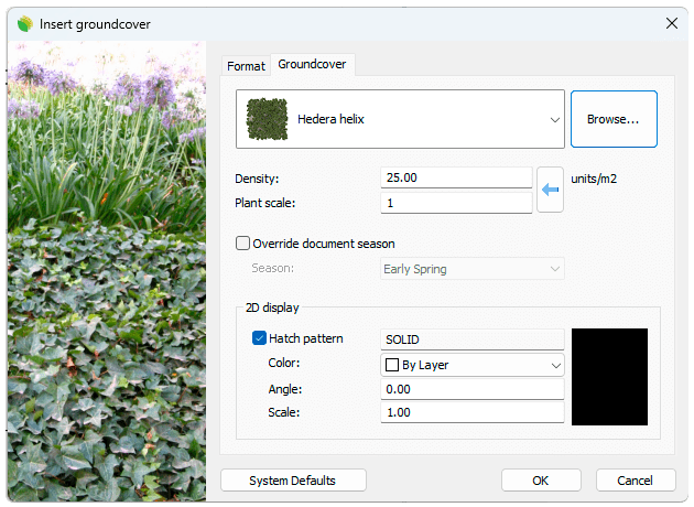
Insert dialog box for the Groundcover object
Control Points 
Groundcovers have the same control points as the curves used to generate them.
In addition, they have a Move control arrow to move the whole Groundcover object.
Groundcover control points are automatically enabled when selecting groundcovers one by one. To turn one ore more Groundcover object control points on, just select the groundcovers and run the PointsOn command (or press F10). To turn the points off, press the Esc button or run the PointsOff command.
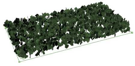
Control points on Groundcovers
Options and Parameters
The groundcover insert options and parameters are divided in different tabs, and are available from different dialogs:
- Plant insert dialog box (only available when inserting new plants).
- Properties area in Edit Panel.
- Object Properties dialog.
- Properties Explorer dialog.
General
General attributes for the groundcover object: Name, Color, Layer, and Transparency (only visible in Conceptual display mode).
Groundcover
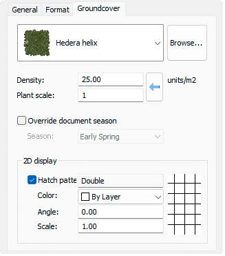
Groundcover tab in Properties area of Edit panel.
- Species: Name of the selected groundcover or plant species. The combo displays a list of the different vegetation species that have been already inserted in the current model. You can select a plant species from that list, or select a new one from the Plant Database, after clicking on the Browse... button.
- Density: indicates the amount of vegetation specimens in units/m2 inside the boundary curve.
- Override global season: when checked, the species will be rendered according to their representation for the selected season.
- 2D display: hatch pattern attributes for the groundcover representation in 2D.
Format
- Caliber: dimensions of the plant species bark. There are some range of values available that go from 10 to 130 mm, but you can type any other value.
- Presentation mode: there are three types of presentation modes available, but you can type new ones.
- Naked root
- Root ball
- Container
Edit options
These are the edit options for the groundcover object, available in the Edit area of the Edit panel:
 Update
- Copy properties from another object
- Copy to another curve
- Extract curves
- Adjust
- Don't adjust to terrain
- Groundcover
 Edit species
 Label. (This command only appears when the groundcover has no label assigned.)
 Identify label. (This command only appears when there is a plant label referencing this groundcover in the model)
 Insert photo
- Add hole: this command subtracts a boundary from a groundcover
Groundcover graphical display
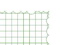
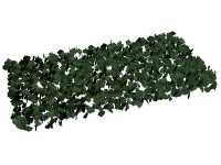
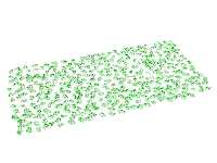
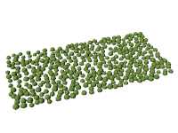
RhinoLands offers different simultaneous 2D and 3D displays of groundcovers on the drawing, with the purpose of handling plants from three different conceptual levels. The Groundcover representation display can be changed in the Document properties.
Groundcover 2D display
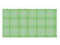
|
|
| Crown and setting out symbol representations | 2D corner detail |
Groundcover 3D display
|
|
|
| Realistic | Detailed | Conceptual |
 left click