Terrain Add Inner Boundary
 left click
This command adds an inner boundary to the terrain using a closed curve. The inner boundary extracts an interior part of the terrain without considering it in the earthmoving volume calculations, which enables more precise terrain modeling.
Add a terrain inner boundary
Steps:
- Pick a terrain. Press Enter or right-click to confirm the selection.
- Select a closed curve to define the new terrain inner boundary.
- The terrain will update, creating an inner boundary that encloses the specified area.

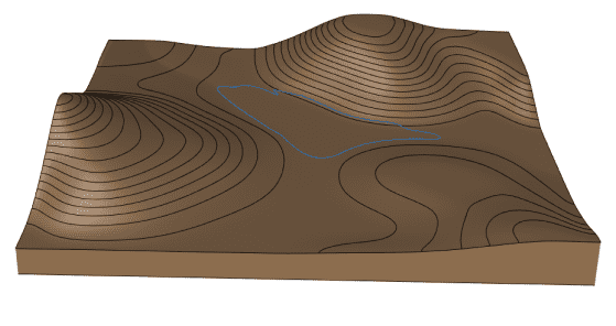
Existing terrain with the curve to define an inner boundary

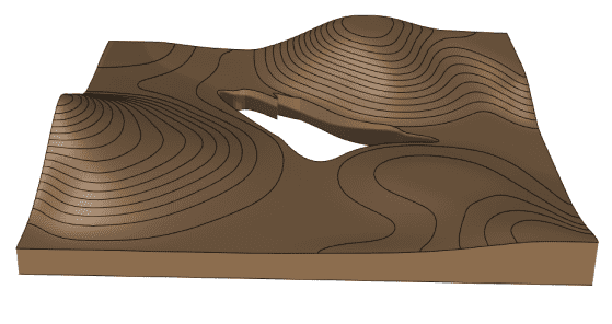
Terrain with the new inner boundary
Control points
The control points of the inner boundary allow you to modify the shape and position of the boundary itself. They are the same as those of the curve used to generate it. In addition, there is a move control arrow to reposition the entire boundary area.
These control points are integrated with the terrain and are visible when the terrain's control points are enabled.
Control points can be disabled in the Boundary tab, in the Properties area of the Edit panel, after selecting the inner boundary from the selection list.
Options and Parameters
The Inner boundary parameters are the same as those for the Boundary object. They can be edited from the Boundary tab in the Properties area of the Edit panel, once selected under the Boundary list.
For the Boundaries objects to appear in the selection list, the terrain must first be selected from the viewport.
Edit options
These are the edit options for the inner boundary, available in the Edit area of the Edit panel:
