Import DEM file
 left click
This command allows you to generate a terrain from a DEM file.
A DEM (Digital Elevation Model) file is a simple, regularly spaced grid of elevation values.
After running the laImportDem command, the Import DEM dialog will appear.
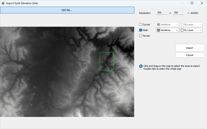
Import DEM file dialog
This dialog is divided into two parts. A navigation area over the image generated from the dem file and the import settings.
Steps:
- Click on the DEM file... button and browse in your PC for a DEM file with a compatible format (*.tif, *.tiff (untiled TIFFs), *.png, *.txt or *.asc ). The file will be imported as a black and white image whose pixels represent different elevation values.
- Draw a rectangle on the image to indicate the area you want to import, or double-click to select the entire map area.
- Specify the import settings:
- Curves: imports the section contour curves scanned from the image. You can choose the layer and color in which they will be created. These curves can be used later on to generate the terrain with the laTerrain command.
- Mesh: a mesh tagged as a terrain with the elevation points will be created. You can choose the layer and color in which it will be created.
- Terrain: a terrain will be automatically created with the scanned elevation data.
- Click on the Import button to import the selected area.