Terrain Add Contour
 left click
This command adds a new elevation data to an existing terrain. This input data can be 3D curves, contour lines and point clouds.
Add Contour
Steps:
- Pick a terrain. Press Enter or right-click when done.
- Select the new terrain Elevaton Data (3D curves, contour lines or points) to add to the terrain.
- The selected input will be added to the existing terrain data, and the terrain will be recalculated with the new information.

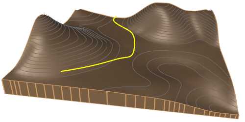
Existing terrain with the curve to add as the new contour line

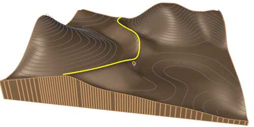
Terrain after having added a new contour line
Control points
The control points for Elevation data are the same as those of the curves or points used in this operation. Additionally, a move control arrow is provided to reposition each of these inputs.
These control points are integrated with the terrain and are visible when the terrain's control points are enabled.
Control points can be disabled in the Elevation data tab,in the Properties area of the Edit panel, after selecting the Elevation data from the selection list.
Options and Parameters
The Elevation data parameters can be edited from the Elevation data tab in the Properties area of the Edit panel, once selected under the Elevation data list.
For the Elevation data to appear in the selection list, the terrain must first be selected from the viewport.

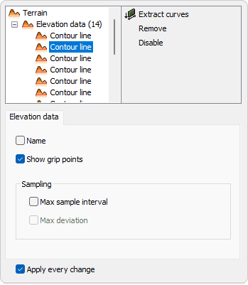
Elevation data tab in Properties area.
- Name
Rename the input. - Show grip points
Enable or disable the control points for the input data. - Sampling
Controls how data points are selected or extracted from the inputs to define the terrain. It influences the accuracy and spacing of the points used in the triangulation process but doesn't directly affect the overall detail of the resulting mesh. - Max sample interval
Define the maximum distance between sampled points along the input curve. A smaller interval increases accuracy but may create a more complex terrain mesh. - Max deviation
Specifies the maximum allowed deviation between the input curve and the simplified version used for terrain generation. Lower values preserve more detail, while higher values allow more simplification.
NoteThe parameters can be edited for each input that defines the terrain. If you select the Elevation Data node from the selection list instead of a specific Input, the modified parameter will be overwritten for all inputs.
Edit options
These are the available edit options for each of the input listed, accessible in the Edit area of the Edit panel:
Selecting Elevation Data node from the selection list instead of a specific Input,the same options are accessible in addition of the following:
