Terrain List
 left click
The laListTerrains command inserts a 2D table displaying the information of the existing terrains in the model, and the operations created on them.
The features of terrain lists are the same as the rest of listing object tools.
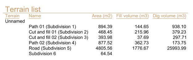
Terrain list
Options and parameters
The options and parameters for Terrain lists are the same as those for the Listing Tools, with the exception of the Element (Terrain) List tab.
Terrain list
These are the default fields for the terrain list object, available under the Element (Terrain) list tab:
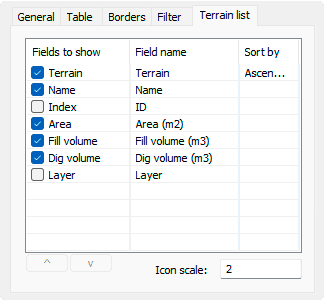
Terrain list tab
- Name: name given to the terrain object.
- Index: terrain identifier (ID).
- Area: flat area of the operation applied on the terrain.
- Fill volume: amount of land movement added to the terrain.
- Dig volume: amount of land movement subtracted from the terrain.
- Layer: Layer of the project where the terrain is located.